![](/images/other/stat-length.png)
![Tocht Te voet Sankt Oswald-Riedlhütte - Fichte - Photo](https://media.geolcdn.com/t/1900/400/99fba781-b2ad-4f50-a612-eecb0bdb3442.jpeg&format=pjpeg&maxdim=2)
Fichte
SityTrail - itinéraires balisés pédestres
Tous les sentiers balisés d’Europe GUIDE+
![Lengte](/images/other/stat-length.png)
Lengte
6,6 km
![Max. hoogte](https://static1.geolcdn.com/siteimages/upload/files/1508320355ic_sort_altitude_max_24dp.png)
Max. hoogte
919 m
![Positief hoogteverschil](https://static1.geolcdn.com/siteimages/upload/files/1508320355ic_sort_den_pos_24dp.png)
Positief hoogteverschil
264 m
![Km-Effort](/images/other/stat-length.png)
Km-Effort
9,7 km
![Min. hoogte](https://static1.geolcdn.com/siteimages/upload/files/1508320355ic_sort_altitude_min_24dp.png)
Min. hoogte
690 m
![Negatief hoogteverschil](https://static1.geolcdn.com/siteimages/upload/files/1508320355ic_sort_den_neg_24dp.png)
Negatief hoogteverschil
150 m
![Boucle](https://static1.geolcdn.com/siteimages/upload/files/16400158638029165_repeat_loop_refresh_sync_direction_icon.png)
Boucle
Neen
Markering
Datum van aanmaak :
2022-02-11 15:10:51.435
Laatste wijziging :
2022-02-11 15:10:51.435
![Te voet](https://static1.geolcdn.com/sitytour/trail-icons/100.png)
2h12
Moeilijkheid : Gemakkelijk
![Scan deze QR-code om de tocht te openen in de SityTrail-applicatie](https://capi.geolives.com/qq0zvz2zws4bq2lad0pu/sitytour/trails/3094005/qr.png?size=200)
Gratisgps-wandelapplicatie
Over ons
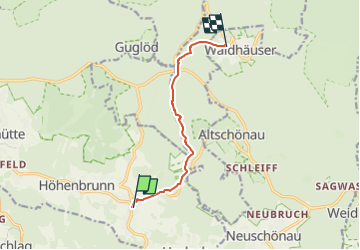
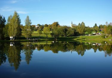
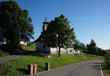
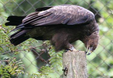
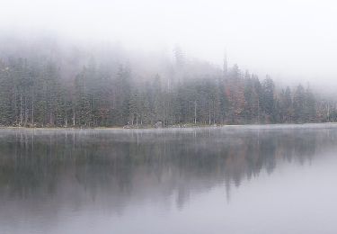
Tocht Te voet van 6,6 km beschikbaar op Beieren, Landkreis Freyung-Grafenau, Sankt Oswald-Riedlhütte. Deze tocht wordt voorgesteld door SityTrail - itinéraires balisés pédestres.
Beschrijving
Trail created by Nationalpark Bayerischer Wald.
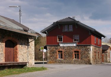
Symbol: Pflanzensymbol (Fichte) in schwarz auf weißem quadratischem Grund
Plaatsbepaling
Land:
Germany
Regio :
Beieren
Departement/Provincie :
Landkreis Freyung-Grafenau
Gemeente :
Sankt Oswald-Riedlhütte
Locatie:
Unknown
Vertrek:(Dec)
Vertrek:(UTM)
384875 ; 5416537 (33U) N.
Opmerkingen
Wandeltochten in de omgeving
![Tocht Te voet Neuschönau - Dachs - Photo](https://media.geolcdn.com/t/375/260/bd4d4b66-a4a1-483f-a98d-2833317cd1dc.jpeg&format=jpg&maxdim=2)
![Te voet Te voet](https://static1.geolcdn.com/sitytour/trail-icons/100.png)
Dachs
Te voet
Gemakkelijk
Neuschönau,
Beieren,
Landkreis Freyung-Grafenau,
Germany
![](/images/other/stat-length.png)
4,5 km | 5,7 km-effort
1h 17min
![](https://static1.geolcdn.com/siteimages/upload/files/16400158638029165_repeat_loop_refresh_sync_direction_icon.png)
Ja
![Tocht Te voet Neuschönau - Haustaube - Photo](https://media.geolcdn.com/t/375/260/78aeb269-300f-4d79-aaf4-32920732cb70.jpeg&format=jpg&maxdim=2)
![Te voet Te voet](https://static1.geolcdn.com/sitytour/trail-icons/100.png)
Haustaube
Te voet
Gemakkelijk
Neuschönau,
Beieren,
Landkreis Freyung-Grafenau,
Germany
![](/images/other/stat-length.png)
6,8 km | 9,5 km-effort
2h 8min
![](https://static1.geolcdn.com/siteimages/upload/files/16400158638029165_repeat_loop_refresh_sync_direction_icon.png)
Ja
![Tocht Te voet Grafenau - Bärenpfad - Photo](https://media.geolcdn.com/t/375/260/5eafdca3-2c73-440b-a078-a897ca2e98e6.jpeg&format=jpg&maxdim=2)
![Te voet Te voet](https://static1.geolcdn.com/sitytour/trail-icons/100.png)
Bärenpfad
Te voet
Medium
Grafenau,
Beieren,
Landkreis Freyung-Grafenau,
Germany
![](/images/other/stat-length.png)
15,3 km | 21 km-effort
4h 49min
![](https://static1.geolcdn.com/siteimages/upload/files/16400158638029165_repeat_loop_refresh_sync_direction_icon.png)
Neen
![Tocht Te voet Neuschönau - Laubbaum - Photo](https://media.geolcdn.com/t/375/260/99fba781-b2ad-4f50-a612-eecb0bdb3442.jpeg&format=jpg&maxdim=2)
![Te voet Te voet](https://static1.geolcdn.com/sitytour/trail-icons/100.png)
Laubbaum
Te voet
Gemakkelijk
Neuschönau,
Beieren,
Landkreis Freyung-Grafenau,
Germany
![](/images/other/stat-length.png)
4,7 km | 7,4 km-effort
1h 41min
![](https://static1.geolcdn.com/siteimages/upload/files/16400158638029165_repeat_loop_refresh_sync_direction_icon.png)
Neen
![Tocht Te voet Neuschönau - Rehbock - Photo](https://media.geolcdn.com/t/375/260/a41e7fd9-4ee4-4705-9a63-55b242f33cfa.jpeg&format=jpg&maxdim=2)
![Te voet Te voet](https://static1.geolcdn.com/sitytour/trail-icons/100.png)
Rehbock
Te voet
Gemakkelijk
Neuschönau,
Beieren,
Landkreis Freyung-Grafenau,
Germany
![](/images/other/stat-length.png)
5,6 km | 7,3 km-effort
1h 39min
![](https://static1.geolcdn.com/siteimages/upload/files/16400158638029165_repeat_loop_refresh_sync_direction_icon.png)
Ja
![Tocht Te voet Sankt Oswald-Riedlhütte - Fuchs - Photo](https://media.geolcdn.com/t/375/260/5bc774a9-20a4-4408-ac3e-051dfcdb162a.jpeg&format=jpg&maxdim=2)
![Te voet Te voet](https://static1.geolcdn.com/sitytour/trail-icons/100.png)
Fuchs
Te voet
Gemakkelijk
Sankt Oswald-Riedlhütte,
Beieren,
Landkreis Freyung-Grafenau,
Germany
![](/images/other/stat-length.png)
8,3 km | 11 km-effort
2h 29min
![](https://static1.geolcdn.com/siteimages/upload/files/16400158638029165_repeat_loop_refresh_sync_direction_icon.png)
Ja
![Tocht Te voet Neuschönau - Luchs - Photo](https://media.geolcdn.com/t/375/260/8c452737-ba5c-48cf-946c-b9516cf7a468.jpeg&format=jpg&maxdim=2)
![Te voet Te voet](https://static1.geolcdn.com/sitytour/trail-icons/100.png)
Luchs
Te voet
Gemakkelijk
Neuschönau,
Beieren,
Landkreis Freyung-Grafenau,
Germany
![](/images/other/stat-length.png)
5,7 km | 9,1 km-effort
2h 3min
![](https://static1.geolcdn.com/siteimages/upload/files/16400158638029165_repeat_loop_refresh_sync_direction_icon.png)
Neen
![Tocht Te voet Grafenau - Echtes Springkraut - Photo](https://media.geolcdn.com/t/375/260/b91fee45-5955-404a-a89c-86514b16f347.jpeg&format=jpg&maxdim=2)
![Te voet Te voet](https://static1.geolcdn.com/sitytour/trail-icons/100.png)
Echtes Springkraut
Te voet
Gemakkelijk
Grafenau,
Beieren,
Landkreis Freyung-Grafenau,
Germany
![](/images/other/stat-length.png)
10,2 km | 13,9 km-effort
3h 10min
![](https://static1.geolcdn.com/siteimages/upload/files/16400158638029165_repeat_loop_refresh_sync_direction_icon.png)
Neen
![Tocht Te voet Neuschönau - Habicht - Photo](https://media.geolcdn.com/t/375/260/99fba781-b2ad-4f50-a612-eecb0bdb3442.jpeg&format=jpg&maxdim=2)
![Te voet Te voet](https://static1.geolcdn.com/sitytour/trail-icons/100.png)
Habicht
Te voet
Gemakkelijk
Neuschönau,
Beieren,
Landkreis Freyung-Grafenau,
Germany
![](/images/other/stat-length.png)
3,5 km | 5,2 km-effort
1h 11min
![](https://static1.geolcdn.com/siteimages/upload/files/16400158638029165_repeat_loop_refresh_sync_direction_icon.png)
Ja